ssd earned the applause of the judges for employing the latest in sustainable and environmentally sensitive principles.”

Urban Development Institute of Australia Awards for Excellence

Solar powered barbecues and energy-efficient street lighting at Seagrove

Sustainability – Energy

ssd’s projects are designed to maximise energy efficiency and minimise greenhouse gas emissions, through initiatives including design guidelines for homes to improve passive solar performance, optimum solar orientation of home sites, energy-efficient fibre-to -the-home networks, and provision for in-home electric vehicle charging.

pictured – solar powered barbecues at ssd’s Seagrove project, where ssd successfully negotiated with authorities and regulators to pioneer the introduction of energy efficient street lighting.

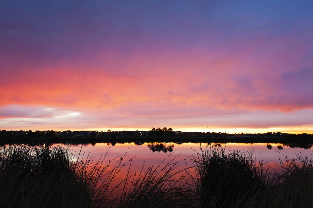
Wetland at Water Edge

Sustainability – Water

Recycled water and design guidelines requiring rainwater tanks save tens of millions of litres of clean drinking water every year at ssd’s projects.

Landscaped wetlands and innovative rain gardens work to naturally treat stormwater to Best Practice Environmental Management Guidelines, modelled using software developed by the Cooperative Research Centre for Catchment Hydrology at Monash University. 

pictured – 60% of ssd’s Water Edge project has been set aside as wetland habitat.

Shade structure overlooking the wetland at Seagrove

Sustainability – Waste & emissions

Guidelines for homeowners encourage compost bins, and kerbside green waste services redirect kitchen scraps and garden clippings to create high-quality compost which is used to help grow food and gardens in Victoria, while reducing greenhouse emissions at the same time.

pictured – ssd’s Seagrove project where all greenhouse gas emissions from the over 5,500 cubic metres of concrete used in roads and infrastructure were voluntarily offset in cooperation with Greenfleet through revegetation works in the Western Port catchment.

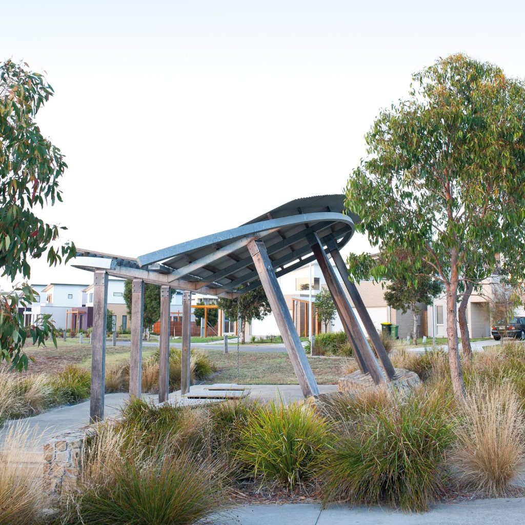
Shade structure incorporating reclaimed timber at Seagrove

Sustainability – Materials

ssd’s architecturally designed landscape elements feature a palette of high-quality materials such as recycled timber.  At ssd’s Arbor project, construction of roads and infrastructure has been designed to be compliant with the EnviroDevelopment Technical Standards to minimise the use of non-renewable resources and environmental impacts.

Design guidelines encourage the use of building materials that have a high content of recycled materials or meet environmental scheme standards, as well as encouraging the use of low VOC paints, floor coverings, and building materials to improve indoor air quality.

pictured – reclaimed timber pole forming the shaft of a shade structure in one of four landscaped parks at ssd’s Seagrove project.

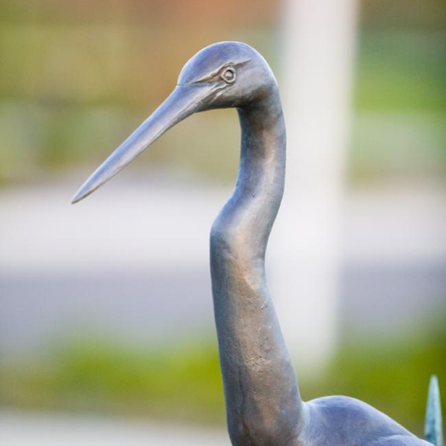
Close up of a bronze sculpture of a Great Egret at Seagrove

Sustainability – Ecosystems

Tens of thousands of indigenous trees and groundcovers have been planted across ssd’s projects, while extensive parks and reserves help to protect important habitat such as mature hollow-bearing trees and wetland areas.  Homeowners are encouraged to plant indigenous plants, while covenants preclude plant species recognised as environmental weeds.

pictured – bronze sculpture at the entry of ssd’s Seagrove project of an endangered Great Egret Ardea Alba – a species of state conservation significance – by award-winning Mornington Peninsula based artist Heather Ellis. The diversity of birdlife has increased from 29 species recorded prior to development to 66 observed native bird species following the construction of Seagrove’s parks and wetland.

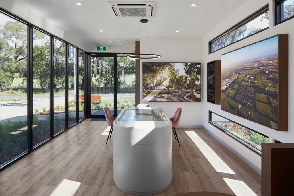
Land Sales Centre with information on sustainability initiatives at Arbor

Sustainability – Community

ssd’s sustainability initiatives can only be successful in the long term if they have the support of the community.

At ssd’s Seagrove project, all homeowners have been offered a complimentary 12-month membership to Urban Landcare and receive a welcome gift of 30 native plants grown from indigenous seed, and a site visit from a Landcare project officer who can provide advice on water-wise, wildlife-friendly gardening.

pictured – land sales centre at ssd’s Arbor project, with wall-mounted display screens providing information for residents on Arbor’s thirty different sustainability initiatives.

ssd is to be congratulated for taking a leading role in demonstrating these sustainable practices.”

Sustainability Victoria

Portfolio – Seagrove Phillip Island

469 lots | completed 2020

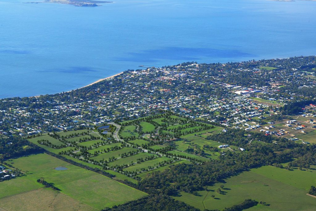
Seagrove has been recognised for environmental excellence in the Urban Development Institute of Australia Awards for Excellence.  Seagrove is located 700m from the beach in Cowes on an undulating site featuring bay views, rich native birdlife and eucalypt woodland of regional conservation significance.

Computer generated aerial image of Seagrove
more information

ssd’s first project, Seagrove was developed on the family’s 48-hectare property, 800m from the main street of Cowes and surrounded by existing residential subdivisions to the east and north, through a development agreement framework.

ssd’s development agreement allowed flexibility for the sale of one quarter of the site as an undeveloped parcel to a retirement village developer, bringing forward a significant portion of the sale proceeds.   Overall, gross sales proceeds exceeded original estimates by 52%.  Development costs were 6% lower, resulting in of a more than doubling of the family’s original projected net sale proceeds.

Ultimately, the retirement village development did not proceed beyond an initial display village, with ssd purchasing back the land to complete the original vision for the master plan.

Seagrove introduced a range of environmental firsts for the region including energy-efficient street lighting, and an integrated approach to water sensitive urban design incorporating a 23 million litre central wetland, mandatory 4,500L rainwater tanks and ephemeral rain gardens in every street.

“sets a new benchmark for sustainable residential development”

Urban Development Institute of Australia Awards for Excellence

Other key environmental features include recycled water, solar-powered barbecues, extensive landscaped buffers and a biolink, and the replacement of 800m of existing overhead powerlines with underground power.  All greenhouse gas emissions from concrete utilised in the construction of Seagrove were voluntarily offset in cooperation with Greenfleet through revegetation works in the Western Port catchment.

Design guidelines and an independent architectural approval process encourage contemporary built form and include practical measures to address sustainability, including solar efficient design standards and a prohibition on the planting of environmental weed species. 

Local community groups contributed to the design process, providing valuable local knowledge – particularly in relation to landscaping and habitat creation.  ssd has sought to increase community engagement with interpretive signage describing environmental initiatives, public art, and complimentary twelve-month membership of Urban Landcare for all purchasers, including a gift of 30 native seedlings grown from indigenous seed of local provenance

Seagrove’s curvilinear urban form maximises the use of the topography and retention of existing trees.  Extra-wide streetscapes landscaped with rain gardens, massed plantings of indigenous groundcovers and copses of native trees, generous lot widths and covenants precluding front fencing add to a relaxed feeling of space in keeping with the island’s character.  The urban form also ensures home sites enjoy optimum solar orientation and maximises permeability to reduce average trip lengths and encourage walking and cycling.

Four landscaped open spaces feature extensive walking paths and 130m of elevated boardwalks and a feature bridge across the wetland.  Bold geometry, with large radii and simple, elegant architecture, complement the organic shapes of the street layout.  High-quality materials such as natural stone and recycled timber were selected to reflect the island’s natural values.

Over 2,000 indigenous trees, 18,000 indigenous mid-storey and ground-storey plants, and 32,000 wetland plants have been planted at Seagrove.   In Seagrove Park, over 4,300m2 of mulched garden beds and massed plantings of indigenous groundcovers help to preserve hollow-bearing trees within eucalypt woodland of high conservation significance, contributing to a more than doubling of the diversity of observed native birdlife.

seagrove.com.au >

Portfolio – The Rise at Lyndhurst

348 lots | completed 2009

The Rise at Lyndhurst features over three hectares of high-quality landscaping including its iconic, heritage listed Moreton Bay Fig tree on the hill and a wetland with elevated boardwalks, located on undulating land opposite the Cranbourne Wetlands Nature Reserve and only 300m from Lynbrook station.
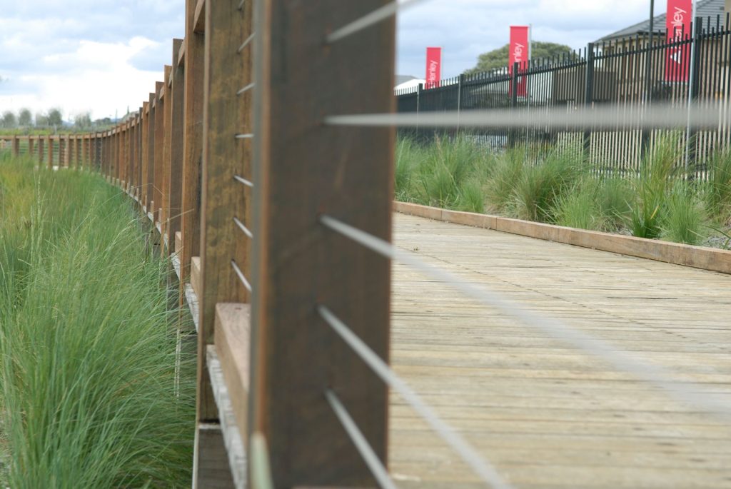
Timber boardwalk over the wetland at with display homes in the background at The Rise
more information

ssd created The Rise through a development agreement with the landowner of a 32-hectare site surrounded to the north and south by existing residential subdivisions, and to the east by the Cranbourne rail line.

The Rise demonstrated that environmentally sustainable design principles could be successfully applied to residential development in Melbourne’s competitive southeast growth corridor in a way that enhanced the commercial outcome.

The Rise achieved price premiums above land in surrounding estates, with gross sales proceeds exceeding original estimates by 25%.  Development costs were 2% lower than budget, resulting in a net return to the landowner 46% greater than originally estimated.

A curvilinear urban form created streets that responded to the natural contours of the land, emphasising one of the key points of difference of The Rise, as well as preserving archaeological sites of cultural heritage sensitivity.  The degree of curvature was controlled within set parameters to preserve the underlying connectivity of the road network, and to keep the solar orientation of lots as close to ideal as possible.  The exception to this curvilinear form is Sunline Way, which was aligned from the estate entry to create a view axis framing a series of broad landscaped steps and gently rising grassed open space leading towards the signature Moreton Bay Fig tree on the top of hill.

The Rise’s design guidelines encourage contemporary built form and include practical measures to address sustainability, including rainwater tanks, solar efficient design and a prohibition on the planting of environmental weed species.  The guidelines were developed in consultation with major builders, to ensure a higher standard than competing estates without being overly prescriptive or sacrificing affordability.

The Rise includes a diverse range of lot sizes and styles, ranging from large 800m2+ lots to affordable lots with frontages of 10.5m, as well as a medium-density site featuring rear lane access and overlooking the principal public open space.

Instead of turning its back to Western Port Highway like the existing developments to the north and south, The Rise presents an active interface.  Lots are separated from the highway by a service road and a 20m wide reserve landscaped with indigenous trees and understorey and featuring a wetland and boardwalk. As well as representing a better urban design outcome, the lots facing the highway were highly sought after by display builders, achieving significant sale premiums over retail pricing and being developed into one of the largest display villages in the southeast.

Over 700 indigenous trees, 11,000 indigenous mid- and ground-storey plants, and almost 9,000 wetland plants have been incorporated into the landscape design, with remnant River Red Gums Eucalyptus camaldulensis protected with extensive mulched beds planted with understory species representative of the area’s original vegetation – such as Lomandra, Dianella and Poa.   These mature, hollow-bearing trees provide irreplaceable habitat for birds.

theriselyndhurst.com >

Portfolio – Kings Creek

136 lots | completed 2017

More than one-third of Kings Creek has been preserved as open space for conservation.  Kings Creek is located in the Mornington Peninsula’s fastest-growing area, close to schools, shopping, the marina and Hastings’ redeveloped foreshore precinct.
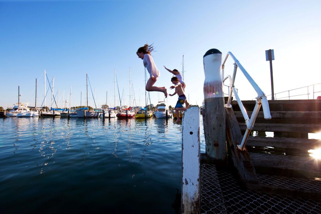
Hasting's marina
more information

Taking its name from the watercourse that runs through the site, Kings Creek is surrounded on the north, west and south by existing residential subdivisions.

Kings Creek is located close to the Yaringa Marine National Park and Western Port Ramsar site, and forms part of a UNESCO Biosphere Reserve.

Kings Creek was developed under a development agreement with the landowners.  After completion of the first stage, the landowners sought to access the balance of their sale proceeds earlier.  ssd acquired the balance of the 11.5-hectare site on commercial terms, matching the best offer received by the landowners, before completing the remaining stages.

Construction was challenged by extremely difficult geotechnical conditions and unanticipated Council requirements; however, the additional costs were more than offset by increased gross sales proceeds – 35% greater than forecast – ensuring that overall net sales proceeds exceeded initial estimates.

Kings Creek’s 136 residential home sites were designed around an extensive four-hectare park which comprises over one-third of the total site.  The park has been created to preserve remnant vegetation of high conservation significance.   The masterplan maximised the number of home sites with park views, with an extra-wide entry avenue designed as a view axis toward the park creating a sense of arrival for residents.

Home site dimensions were informed by the latest home designs from leading builders, with a diversity of lot sizes tailored to match observed market demand.  The urban form was designed to reduce average vehicle trip lengths and to encourage walking and cycling, while ensuring optimum solar orientation of all home sites, allowing residences to be designed to maximise passive solar heat gain in winter, and minimise unwanted solar penetration in summer.

The internal road network was connected to the existing residential development to the west to accommodate a new public transport route.   Kings Creek is located within walking distance of schools, parks, town centre, and the redeveloped Hastings foreshore precinct.

Design guidelines encourage contemporary built form and include practical measures to address sustainability, including 2,000 litre rainwater tanks, solar efficient design and a prohibition on the planting of environmental weed species. 

Kings Creek incorporates energy efficient street lighting, and a water treatment system designed to naturally treat stormwater to Best Practice Environmental Management Guidelines before it enters the bay.  Kings Creek was the first residential estate on the Mornington Peninsula to provide broadband connections to all homes.

Over 5,000 indigenous plants and trees were planted, and a comprehensive multi-year management program was put in place to protect and enhance the conservation values of the park, which provides habitat for a range of native animals including the endangered Southern Brown Bandicoot.

kingscreek >

Portfolio – Water Edge

80 lots | completed 2016

Home sites at Water Edge have been designed to take advantage of the water views, with 60% of the site set aside as wetland habitat.  Water Edge is a located in sought-after Narre Warren, surrounded by excellent schools and just a stone’s throw from the beautiful Berwick Village.

Cormorant taking flight over the wetland at Water Edge
more information

Water Edge was developed under a development agreement with the landowners of a 12-hectare site surrounded by existing residential development to the west and south, and the Berwick Springs Wetland to the north.  The development was staged to allow the landowners to continue to reside in their home on the land while the first stages were constructed.

ssd created a landscaped linear wetland along the western edge of the site providing a link from the existing Berwick Springs Wetland and incorporating water sensitive urban design principles to naturally remove more than 90% pollutants from stormwater.

A feature stone-clad bridge provides a link across the wetland to nearby recreational amenities to the west.  Next to the bridge, a seating node and a skillion form shade structure provide residents with a place to enjoy the water views to the north.  Walking and cycle paths and pedestrian bridges provide further links to the residential areas to the north and east.

The urban form maximises view opportunities from home sites across the wetlands, with half of Water Edge’s 80 home sites enjoying front-row water views.  The overall mix of lot sizes was optimised based on market research, achieving per-square-metre price premiums 12% to 24% higher than surrounding competing projects, and driving higher than forecast net sale proceeds for the landowners.

Although tightly constrained by the geometry of the site, a degree of curvature was incorporated into the streetscapes to enhance their character, along with a palette of high-quality materials such as porphyry paving. 

The design response also provides optimum solar orientation of all home sites, allowing residences to be designed to maximise passive solar heat gain in winter, and minimise unwanted solar penetration in summer.

Water Edge incorporates environmental initiatives including energy efficient street lighting, recycled water, fibre-based broadband and extensive revegetation with over 50,000 trees, groundcovers and wetland plants.

Design guidelines encourage contemporary built form and include practical measures to address sustainability, including 2,000 litre rainwater tanks, solar efficient design and a prohibition on the planting of environmental weed species. 

The wetlands at Water Edge are a unique ecosystem that provide food, water, and habitat to a diversity of plants and animals, including some bird species which fly from breeding grounds in the northern hemisphere every year to spend summer feeding at Water Edge.

wateredge.com.au >

Portfolio – Arbor

301 lots | now selling

Arbor is the only project in Cardinia to achieve national EnviroDevelopment certification in all six elements of ecosystems, waste, energy, materials, water and community.  Arbor is superbly located at the base of the foothills of the Dandenong Ranges, close to the Officer town centre and train station. 
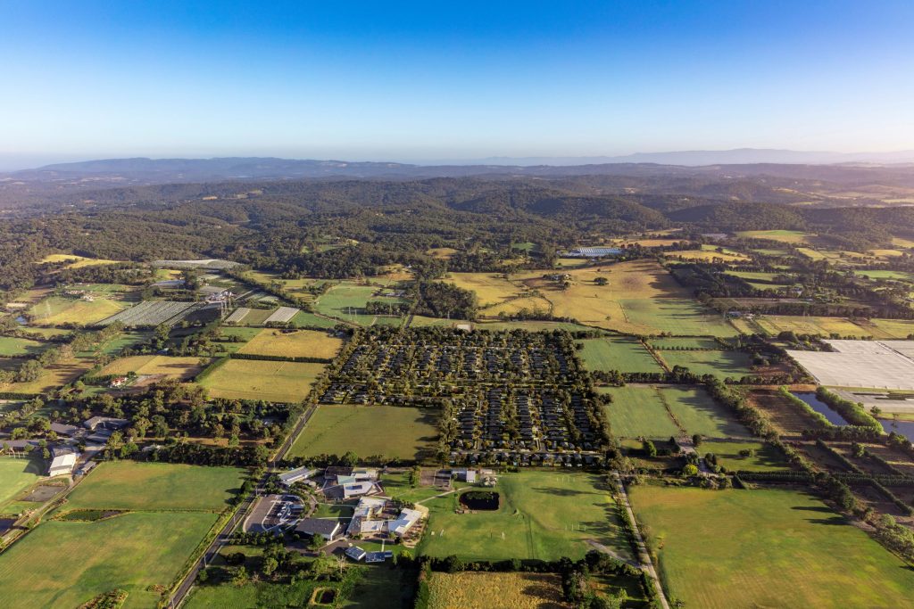
Computer generated aerial image of Arbor
more information

Surrounded by existing urban areas of Pakenham to the east, and Berwick to the west, residential development in Officer has been slowed by fragmented ownership of smaller land parcels.

To develop Arbor, ssd brought together three separate landowners through a development agreement framework to create a holistically planned development across a 20-hectare site and deliver a better commercial outcome for each of the owners. 

Arbor’s multi-award-winning consultant team includes town planners Urbis, landscape architects Tract Consultants, and engineers and surveyors Charlton Degg. 

Environmental sustainability formed the core of Arbor’s brand and marketing strategy.  In its first year on the market, Arbor achieved an average sales rate of 30 lots per month, compared with four lots per month for the two closest competing developments, while simultaneously achieving average lot prices premiums of 11% and 20% above the same competitors. 

The construction phase was challenged by extremely long approval timeframes from authorities, up to three years in some instances; however, Arbor remains commercially successful, with net sale proceeds to the landowners on track to exceed initial forecasts by 60% on average.

Arbor was designed to enhance, protect, and celebrate the unique character of the surrounding environment.

The gently undulating shape of the land lends a special character to Arbor. Extensive plantings of native and indigenous species create important habitats for local birdlife, while the carefully designed path network, play spaces, skillion-form shade structure and seating nodes provide ample opportunity for residents to pause and appreciate this special environment. Mature eucalypts have been protected and enhanced through responsive design.

A central green spine creates a view axis to the environmentally significant Gum Scrub Creek, a short stroll to the east, as well as providing a landscaped bookend to each of Arbor’s streetscapes, ensuring each home site shares a visual connection to nature.

Home sites at Arbor are generously proportioned, creating a premium neighbourhood feel with more green space around every home. The most common lot depth is thirty-six metres – approximately 25% deeper than the average for similar sized lots in the local market. This unconventional approach was identified as part of Arbor’s detailed quantitative design assessment process as providing the optimum overall design solution, reducing construction costs and maximising net sale proceeds compared with more conventional layouts, while also providing a superior outcome for residents and the environment.

Over 20,000 native and indigenous plants and trees provide important habitats and contribute to maintaining local biodiversity.  Homeowners are provided with extensive information on indigenous plants for landscaping and design controls prevent the planting of species recognised as environmental weeds.  Kerbside green waste collection is available to residents and is promoted to reduce landfill and decrease greenhouse gas emissions.

Arbor seeks to engage with its community around sustainability, with information on thirty different environmental initiatives promoted to residents.  Even Arbor’s Land Sales Centre is powered by accredited 100% renewable electricity.

arborofficer.com.au >

ssd logo

Southern Sustainable Developments Pty Ltd
ABN 42 103 009 678   

Bunurong Country
PO Box 1016, Cowes, Victoria 3922, Australia

info@ssd.au
+61 3 5956 8830

Enviro Development Certified mark